Geography
History of Development
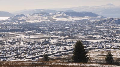
The Foothills Knoll has spectacular views of Greater Vernon, and so is visible from just about any area of the city. It is located at the top of the Foothills subdivision, which is accessed via Silver Star road on the way up to Silver Star Mountain, about 7 kilometres east of Highway 97.
Locals historically have referred to the knoll as "Jackass Mountain", although most Vernon residents now refer to the area simply as "The Foothills".
The Foothills subdivision, though geographically distant from the city center, was annexed into the city in the 1980's. Some of the first homes were built on Foothills Drive, Whistler Place, and Sunshine Place in the late 1980's and early 1990's. At that time, Silver Star Road still followed what is now named Star Road, and the road to the Foothills subdivision dead ended at the ravine just east of Foothills Drive.
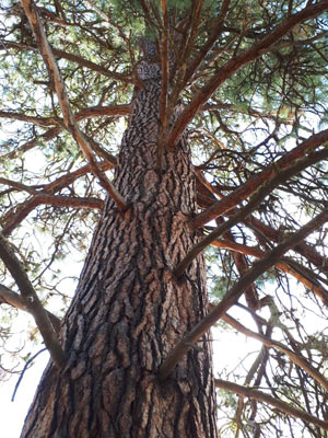
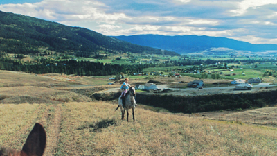
The hillside teemed with wildlife. It was not uncommon to see herds of mule deer, sometimes numbering 30 or more animals. Golden eagles are often seen soaring above the grasslands, riding thermals above the knoll. The area still has abundant wildlife, especially near the top of the knoll where there has been no development. The ground is criss-crossed with animal trails.
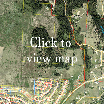
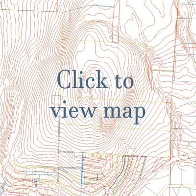
Satellite and Topographic Maps
Development Creeps Up the Hill
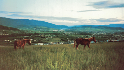
The Foothills subdivision, as conceived by its original developer Bill Lahowy, was to have a network of horseback riding trails through it. In fact, the Foothills was a very popular area for horseback riding in the 1980's. Horses could be rented from the riding stables at the bottom of the switchbacks, across from the BX Creek trailhead on what is now called Star Road.
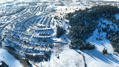
As development progressed, building lots were added on Foothills Place and Marmot Court, and once the ravine past Foothills Drive was filled in, Silver Star Road was redirected to its current route.
The Country Springs development followed, and development has steadily crept up the hillside to the 765 metre elevation -- the elevation of the water reservoir on Sun Peaks Drive.
Development to the Summit?
The area above the Foothills subdivision, popular among day hikers and picnickers, is private land, with allowed use through the goodwill of the landowners. Below are satellite and topographical maps of the area, marked with the subdivision parcels. Some of this land is already being cleared to make way for additional development.
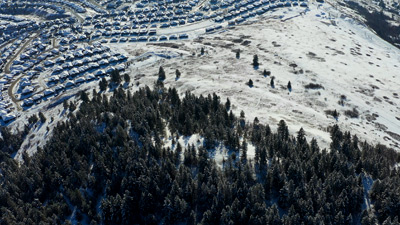
Some say that development has already gone too high up the knoll, and that if it goes any higher, any viewpoints at the summit will be looking right down into residents' back yards. Surprisingly, there are no plans to stop development from going higher up the hill, In fact, plans have been drawn up calling for residential development within metres of the summit!
Is unrestrained development in the public interest?
Is unrestrained development in YOUR interest?
We contend it is not.
Its time to STAND UP AND HAVE YOUR VOICE HEARD!